

New satellite images are showing the extent of the damage caused by deadly flash floods that hit a village in India's north-eastern state of Sikkim in October.
The photos show how the Teesta river broke its banks and submerged a huge portion of a nearby village. The devastating floods killed more than 30 people and destroyed the livelihoods of thousands with dozens of people still missing after being swept away.
The flash flood was triggered by a cloudburst, which caused the South Lhonak glacial lake to burst its banks. The excess water flowed into the Teesta river downstream, causing its water level to rise.
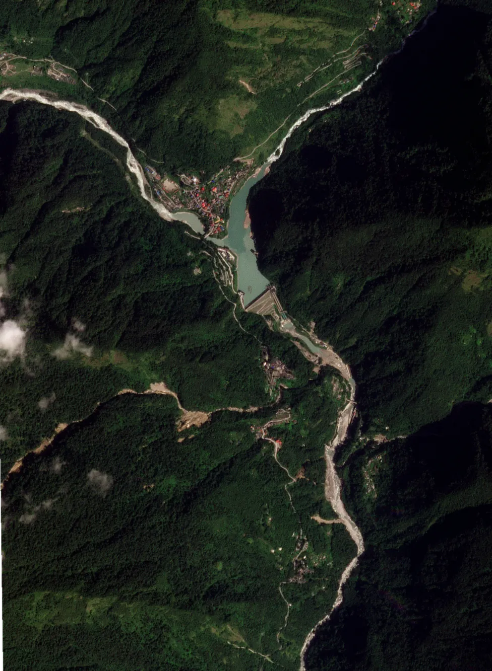
The situation worsened after more water was released into the river from a nearby dam. The gushing water from the river wreaked havoc on the Chungthang village, which adjoins its banks. Earth observation experts at the University of Leicester in the UK have now released photos that show the devastating impact of the floods.
Of the two satellite photos, one shows the village before the floods and one captures it after. In the photo taken before the floods, the Chungthang village, located close to the banks of the Teesta river, as well as the Teesta III dam - which is a short distance away from the village - is intact.
But on 4 October, the Teesta III dam collapsed due to the bursting of the South Lhonak glacial lake. In the photo taken 10 days after the flood, one can see the collapsed dam as well as clusters of houses submerged in debris left behind by floodwaters.
Although the image doesn't capture the flood, it depicts the areas that were submerged, revealing the extent of destruction experienced by Chungthang village. Matthew Payne from the School of Geography, Geology and the Environment at the University of Leicester says that the images could be useful in "tackling climate change".
"This catastrophe is a stark reminder of the escalating challenges faced by the verdant Himalayan regions and the increasing magnitude of flooding events necessitates resilient infrastructure capable of tolerating climate-induced excessive rainfall," he says. Mr Payne adds in a statement that satellite imagery can help track the onset, duration and retreat of floodwaters, providing crucial insights for relief and recovery efforts.
Experts say global warming is causing glaciers to melt faster and this has led to an increase in the water levels of several Himalayan lakes. They also say that this has led to an urgent need for authorities to install early warning systems in these glacial lakes.
Prior to the floods in Sikkim, several studies had warned that there was a high possibility of South Lhonak lake flooding. The lake's area had expanded more than 2.5 times in the past three decades because of a rapidly melting glacier that feeds it, but authorities had not installed an early warning system.
People working at the Teesta III dam told local media that when they received orders to open the dam's floodgates it was too late as water had already started hitting the infrastructure, causing its eventual collapse. Sikkim alone has more than 700 small and large glacial lakes and experts say around 20 are at risk of bursting.