

A dramatic change of weather was in store from this weekend, with weather warnings for strong winds and a new storm named by the Met Office.
Storm Isha - the ninth named storm of the season - will bring heavy rain and strong winds following the ice and snow of the past week. The strongest winds are expected tomorrow (Sunday) and into Monday morning, with two amber warnings issued.
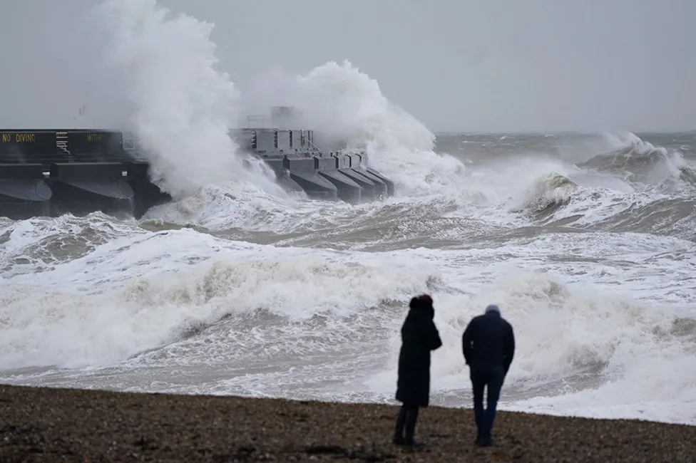
Conditions will also become milder, with Friday the last really cold day. The Met Office was expecting gusts of up to 80 mph (129km/h) in the areas covered by its amber warnings and says injuries and a danger to life are likely from large waves and beach material being thrown onto coastal roads, sea fronts and buildings.
The first warning is for much of southern Scotland, Northern Ireland, northern England, west Wales and south-west England, in force from 18:00 Sunday to 09:00 on Monday. Another for south-east England comes into place from midnight to 09:00 on Monday.
There is a good chance of power cuts, which could affect services such as mobile phone coverage, probable damage to buildings, and some roads and bridges are likely to close. Longer journey times and cancellations are also likely, as road, rail, air and ferry services may be affected.
A spokesperson for Energy Networks Association, which represents Britain's energy network operators, said: "An amber warning brings an increased risk of damage to homes and vital infrastructure.
"Energy network operators are preparing to deal with any damage quickly and safely." More widely across the UK gusts of 50-60mph, reaching 70mph in coastal areas, are expected, with a yellow warning in place from 12:00 today to 12:00 on Monday.
This may bring more localised impacts on travel and infrastructure anywhere across the UK. And there are multiple yellow warnings for rain in parts of Wales, Scotland and northern England into early Monday. With 20-50mm most likely, there could be as much as 80-100mm over higher ground.
The Met Office said heavy rain is likely to lead to disruption from flooding, with some homes and businesses likely to be affected in parts of Wales and northern England. It will also start to feel much warmer - by Sunday the temperatures will be around 5-6C in Scotland but elsewhere 10-13C.
Rising even further on Tuesday to 15 C in southern England, this will be around seven degrees warmer than the average for mid-January. The milder conditions follow an icy blast which brought snow to much of the UK over the last week.
Winds are expected to gradually ease throughout Monday, but low pressure will bring further wet and windy weather on Tuesday morning which will spread eastwards across the UK. Further into the week there are signs conditions will settle in the south, with any wet and windy weather being more confined to the north-west of the UK.